Exploring the Knuckles Mountain Range in Sri Lanka
Location and Geography
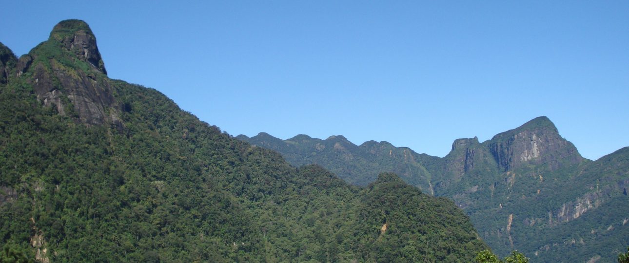
The Knuckles Mountain Range, known locally as Dumbara Mitiyawatha, is located in central Sri Lanka. This range spans over 155 square kilometers and is named for its resemblance to a clenched fist. It lies between the districts of Kandy and Matale, offering a rugged landscape that attracts nature enthusiasts and hikers alike.
Biodiversity and Wildlife
Recognized as a UNESCO World Heritage Site, the Knuckles Mountain Range is celebrated for its rich biodiversity. The area is home to numerous endemic and endangered species. You’ll find lush evergreen forests and clear streams that support wildlife such as leopards, deer, monkeys, and a variety of birds. However, the ecosystem faces threats from large-scale cardamom cultivation and invasive plant species like the Mist Flower, which disrupt native flora.
Trekking and Hiking Trails
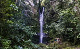
For those seeking adventure, the Knuckles Mountain Range offers a variety of trekking and hiking trails suitable for different skill levels. Popular routes include Mini World’s End, Pitawala Pathana, and Knuckles Summit. Each trail provides stunning panoramic views, so bringing a camera is a must. Be prepared for changing weather conditions, as the trails can be challenging.
Best Time to Visit
The ideal time to explore the Knuckles Mountain Range is during the dry season, from May to September. The weather is generally pleasant, making the trails more accessible. However, mornings and evenings can be chilly, so pack accordingly. Avoid the monsoon season, as heavy rains can make the trails hazardous.
Getting There
To reach the Knuckles Mountain Range, fly into Bandaranaike International Airport in Colombo. From there, travel to Kandy, which serves as the gateway to the range. You can hire a taxi or take a local bus to Kandy. Once there, options include hiring a private vehicle or taking a local bus to reach your chosen trailhead.
Local Transportation
Within the Knuckles Mountain Range, walking is the primary mode of transportation. The trails are well-marked, and local guides are available if you need assistance. Carry a map, plenty of water, and snacks for your hikes. If you plan to explore the surrounding areas, renting a vehicle or hiring a tuk-tuk is convenient.
Accommodation
While there are no accommodations within the Knuckles Mountain Range itself, nearby towns like Kandy, Matale, and Digana offer various lodging options. From budget guesthouses to luxury resorts, you can find accommodations to suit your needs. Booking in advance is recommended, especially during peak season.
Summary of Facts
- Location: Central Sri Lanka, between Kandy and Matale districts
- Geography: Clenched fist-shaped mountain range covering 155 square kilometers
- Biodiversity: UNESCO World Heritage Site with diverse flora and fauna
- Popular Trails: Mini World’s End, Pitawala Pathana, Knuckles Summit
- Best Time to Visit: May to September (dry season)
- Getting There: Fly to Bandaranaike International Airport, then travel to Kandy
- Local Transportation: Walking/hiking, hiring guides, renting vehicles or tuk-tuks
- Accommodation: Available in nearby towns such as Kandy, Matale, and Digana