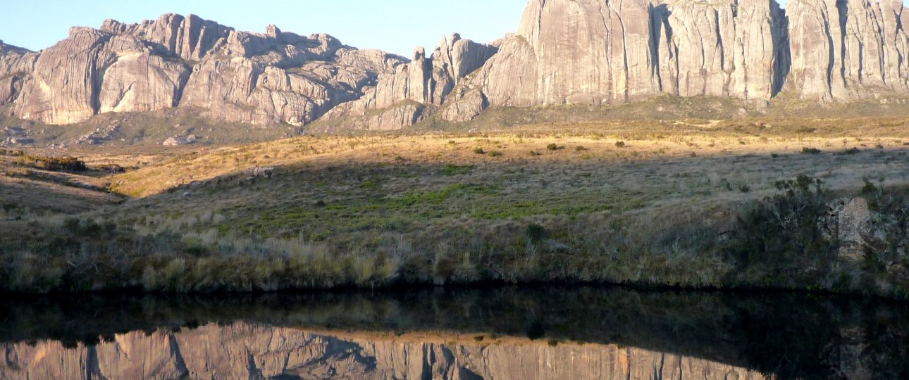
Andringitra Massif: An Adventure in Madagascar
Getting There
Reaching Andringitra Massif is part of the adventure. Start at Ivato International Airport in Antananarivo, Madagascar’s capital. From there, you can either fly domestically to Fianarantsoa or opt for a scenic 10-hour drive to Ambalavao. Once in Ambalavao, hiring a local guide is advisable. They offer not just safety but also insights into the region’s history and culture.
When to Visit
The dry season, from April to November, is the best time to explore Andringitra Massif. The weather is generally pleasant, and the trails are more accessible. The rainy season, from December to March, can make hiking trails slippery and challenging, so plan accordingly.
Exploring Andringitra Massif
Hiking Trails
Andringitra Massif offers a variety of hiking trails for all skill levels. The Imarivolanitra Circuit is a favorite, taking you through diverse landscapes, including lush forests and granite peaks. For a more challenging trek, consider ascending Imarivolanitra, formerly known as Pic Boby. At 2,658 meters, it is Madagascar’s second-highest peak and offers stunning panoramic views.
Wildlife Encounters
The park is a biodiversity hotspot. It hosts over fifty species of mammals, including thirteen species of lemurs. Notably, the ring-tailed lemurs here have thicker fur, an adaptation to the colder climate at higher altitudes. Birdwatchers will also find over a hundred species of birds, making it a paradise for wildlife enthusiasts.
Local Transportation
Within Andringitra Massif, walking is the primary mode of transportation. The trails are well-marked, making navigation straightforward. For exploring nearby towns, taxis and minibusses are available, but it’s wise to arrange transportation in advance, especially during peak tourist seasons.
Accommodation
While the landscapes are rugged, comfort is not out of reach. Nearby towns like Ambalavao and Tsaranoro offer eco-lodges and guesthouses. These accommodations provide a comfortable base for exploration and support local communities.
Additional Insights
- Andringitra Massif is part of the Rainforests of the Atsinanana World Heritage Site, recognized for its ecological significance.
- The park covers 31,160 hectares, with altitudes ranging from 700 meters to 2,658 meters.
- Three ethnic groups inhabit the area: the Bara, Bara Haronga, and Betsileo, each contributing to the region’s cultural tapestry.
- Expect varying weather conditions, including occasional snowfall and temperatures that can drop to -8°C (18°F).
Andringitra Massif offers a unique blend of adventure and natural beauty, but it’s essential to prepare for its challenges. Whether you’re hiking its trails or observing its wildlife, this destination promises an experience grounded in nature and culture.