Pico Naiguatá: Exploring Venezuela’s Coastal Range
Location and Geography
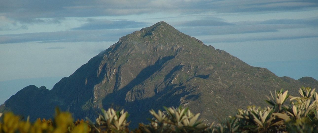
Pico Naiguatá is a prominent peak in Venezuela’s Coastal Range, located approximately 30 kilometers north of Caracas. Standing at an elevation of 2,765 meters (9,072 feet), it offers sweeping views of the Caribbean Sea and the lush valleys below. This mountain is a part of the Avila National Park, a protected area known for its rich biodiversity and stunning landscapes.
Unique Features
The ascent of Pico Naiguatá takes you through a variety of ecosystems, from tropical rainforests to cloud forests. This diversity supports a wide range of plant and animal life, including rare orchids and vibrant hummingbirds. While sightings are rare, the elusive puma also calls this area home.
Hiking Trails
The trails on Pico Naiguatá cater to different skill levels. Whether you’re an experienced hiker or a beginner, you’ll find a path that suits your abilities. The trails offer a mix of challenging climbs and more relaxed walks, all with the reward of breathtaking scenery. Remember to bring a camera to capture the stunning vistas along the way.
Sunrise and Sunset Views
Watching the sunrise or sunset from Pico Naiguatá is an unforgettable experience. The changing colors of the sky create a mesmerizing backdrop against the mountain’s silhouette. Find a comfortable spot, relax, and enjoy the natural spectacle as the day begins or ends.
Best Time to Visit
The ideal time to visit Pico Naiguatá is during the dry season, from December to April. During these months, the weather is generally clear and warm, making it perfect for hiking. However, be prepared for sudden weather changes, as mountain climates can be unpredictable. Carry appropriate gear to ensure a safe and comfortable journey.
How to Get There
To reach Pico Naiguatá, fly into Simón Bolívar International Airport in Caracas. From there, you can take a taxi or bus to the town of Galipán, which serves as the starting point for the ascent. If you’re already in Caracas, local tour operators can arrange transportation to Galipán.
Local Transportation
In Galipán, consider hiring a local guide. They can lead you to the summit while sharing insights about the area’s history and wildlife. Alternatively, rent a 4×4 vehicle to drive to the base of the mountain, but be ready for rugged terrain and narrow roads.
Summary of Facts
- Pico Naiguatá is located in Venezuela’s Coastal Range, 30 kilometers north of Caracas.
- The mountain stands at an elevation of 2,765 meters (9,072 feet) and offers views of the Caribbean Sea.
- It features diverse ecosystems, from tropical rainforests to cloud forests.
- The area is home to unique flora and fauna, including orchids, hummingbirds, and pumas.
- Hiking trails are available for all levels, offering stunning views.
- Sunrise and sunset views from the mountain are spectacular.
- The best time to visit is during the dry season, from December to April.
- The closest airport is Simón Bolívar International Airport in Caracas.
- From Caracas, you can take a taxi or bus to Galipán, the starting point for the ascent.
- Local transportation options include hiring a guide or renting a 4×4 vehicle.